
CARTA by PLOTT Land Measuring Wheel and Mapping System
| CARTA by PLOTT Land Measuring Wheel and Mapping System |
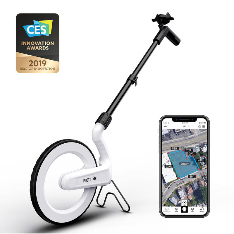
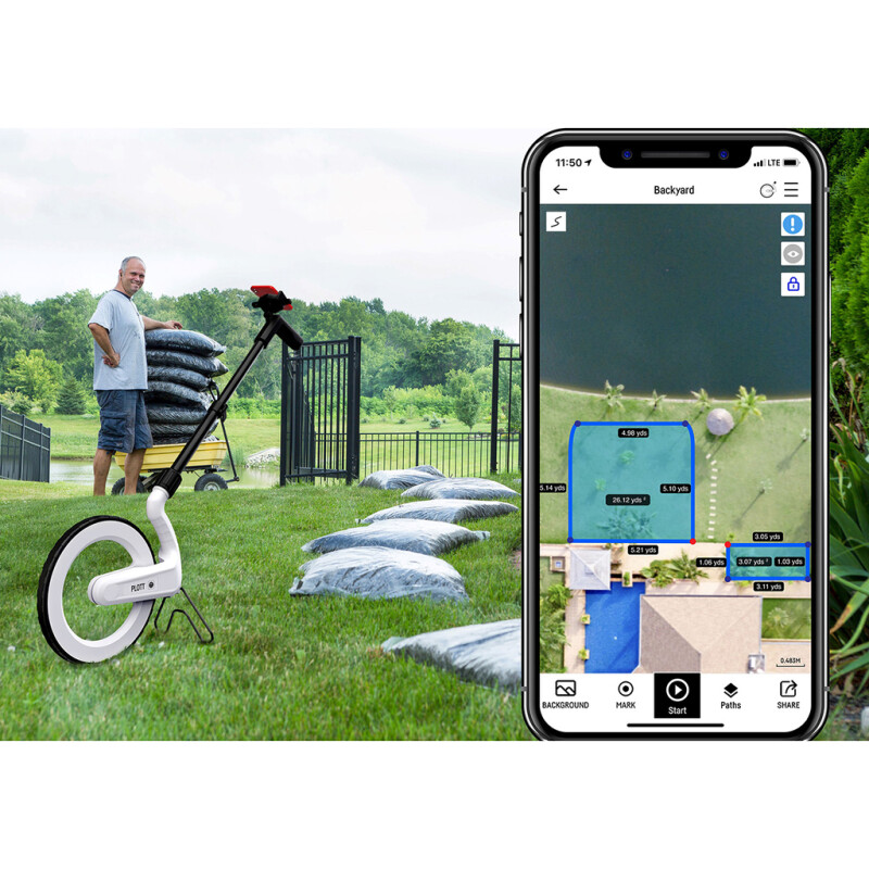
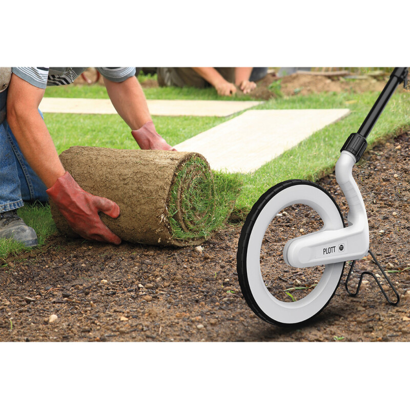
Easily Measure & Map Carta delivers a state of the art, real time mapping and measuring system - displayed directly on your smartphone. Simply wheel along the edges of an area using Carta to digitally capture the shape and dimensions. Carta effortlessly measures ANY curved or freeform shape - then instantly derives square footage, cubic yards/feet, perimeter data, etc. No more squaring off complex shapes then overestimating your material - and inflating your quote. Use Carta to map out a new garden, deck, irrigation systems, and other projects takes only a few easy steps. Let Carta Do The Maths For You Save time, money, and headaches by eliminating the need to do complex math on the job. Carta is the first digital measuring wheel to virtually map as-builts including irrigation systems, drainage fields, outdoor lighting/sound layouts. Easily calculate distance, square footage, cubic yards with Carta. Save important notes, images, and videos on any project to use later or share with others for fast collaboration. Use Carta’s guide mode to relocate selected marks to find buried valve covers, key junction points, etc. |
Overview benefits
Key Features
|
Battery Life: ≥ 18 hours |
| Technical | Carta brings more functionality to your outdoor projects than your standard wheel. The Carta by Plott platform allows you to map & measure projects in real time, mark points of interest, take notes, and guide you back to marked points in the real world. The Overview: A Control Centre for Your Project on Your Phone Carta delivers a state of the art, real time mapping and measuring system – displayed directly on your smartphone. Simply wheel along the edges of an area using Carta to digitally capture the shape and dimensions. Carta effortlessly measures ANY curved or freeform shape – then instantly derives square footage, cubic yards/feet, perimeter data, etc. Reduce Wasted Material Tired of overestimating your materials because of complex shapes? Use Carta to map out a new garden, deck, irrigation systems, and other projects for a much more accurate estimate in a fraction of the time. Measurement & Map In Real Time Effortlessly measure curves and free-form shapes. Simply trace along the edges of an area using Carta to digitally capture the shape and dimensions. Instantly measure the perimeter and calculate the area of curved lawns, pools and other shapes and spaces – regular or irregular. Guidance To Real World Points Using marked points you can relocate key features in a project. Carta will show you where you are relative to where the point is and indicate when you have reached it! Use this to relocate valve boxes, termite boxes, and other underground utilities. Quick, Easy & Exportable Estimates Share projects with co-workers, clients, friends with these file formats: JPG, DXF, CSV, PDF and Plott File. Easily share your projects with colleagues, share the image with clients so they can see exactly what is being done, or create PDFs to help manage accounts. |